![]()
Waikato River Trails
December, 2011
With the thought
of riding some of the Waikato River Trails during the Cambridge Weekend coming up
in March, 2012 Ron, Susan and John went for a little rekkie ride between the
Christmas and New Year weekends.
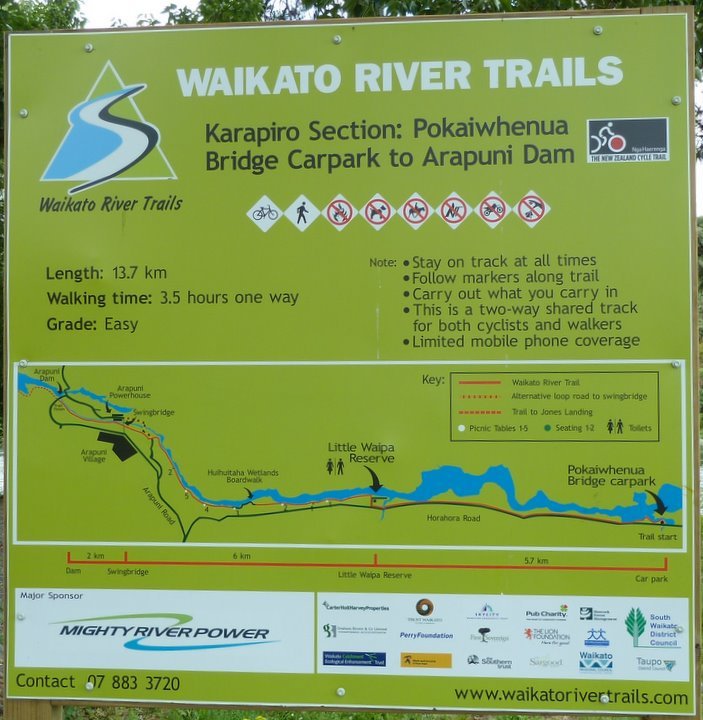
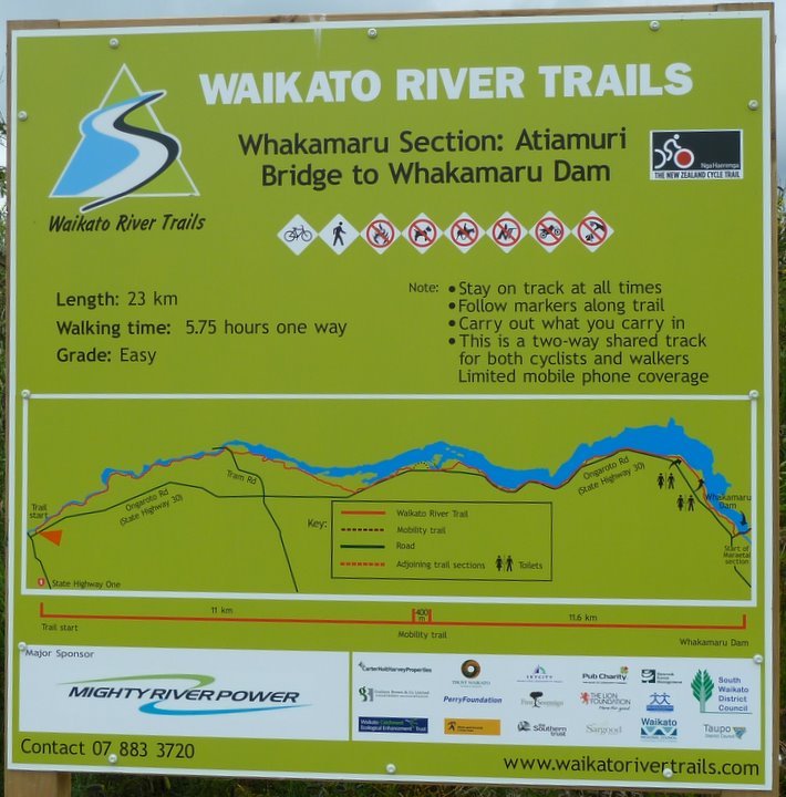
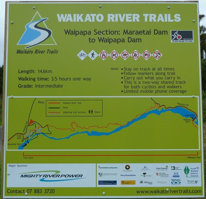
You can view the website for the Waikato River Trails here
After our rides,
we felt that the WRT web site makes the trails look easier than they are.
The Karapiro section is quite easy, with no really steep parts, and with a generally good
surface.
The sections further south are more technical and, although Ron & Susan were using
road bikes, they got
through OK. However, fat tyres made it easier for John.
The signage at
each end of each section was good and, where there was access
at intermediate parts of the trails, there were also signs.
We decided that the "Grade" level applied to walkers.
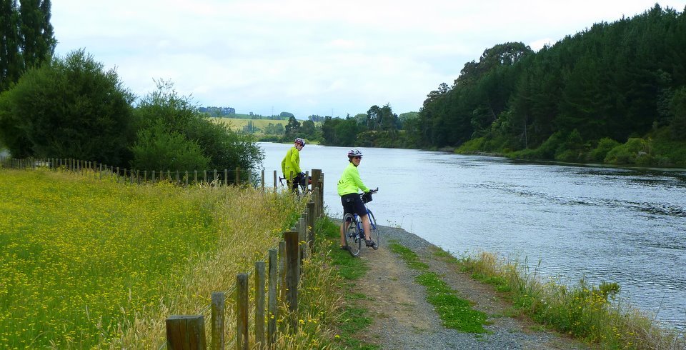
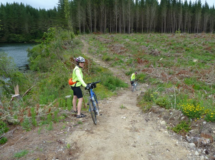
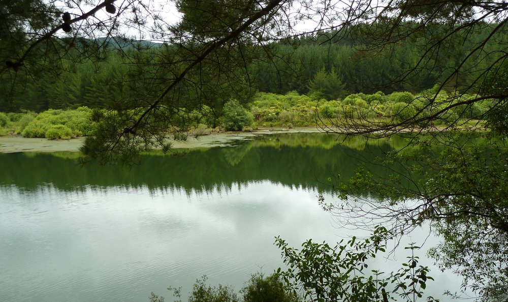
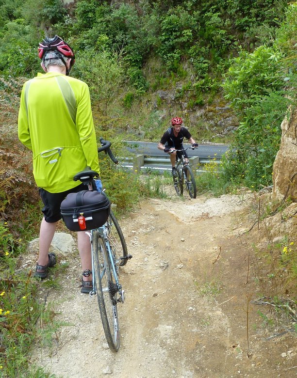
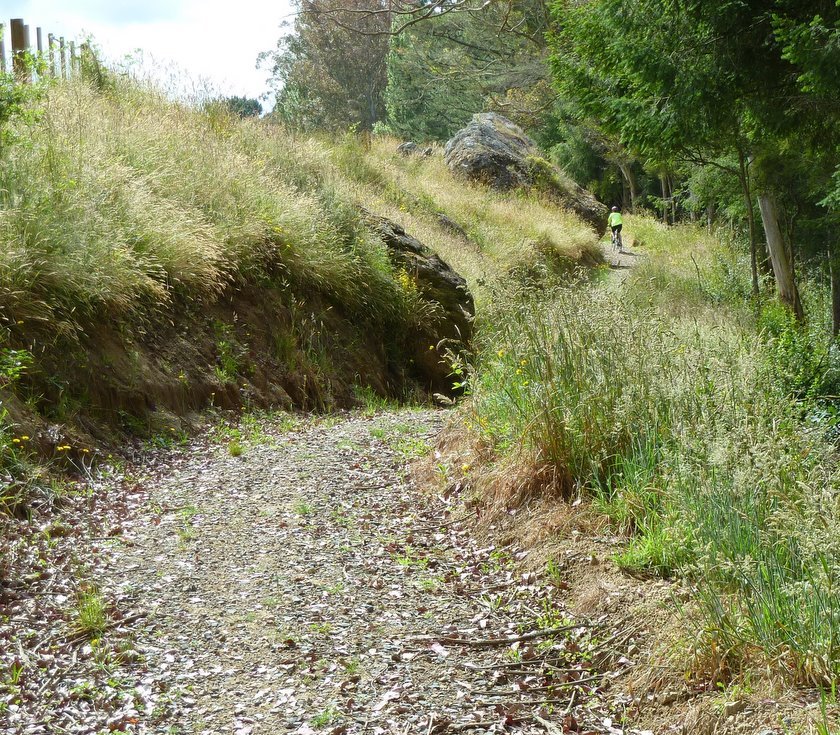
We started out on
the 13.7km Karapiro Section, riding it both ways, but choosing
to use the road on the return for the last 5.7km : there were no
river views along here.
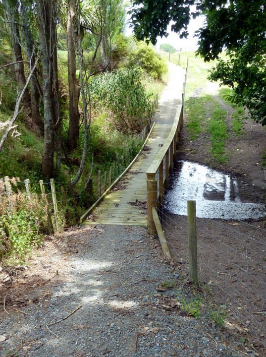
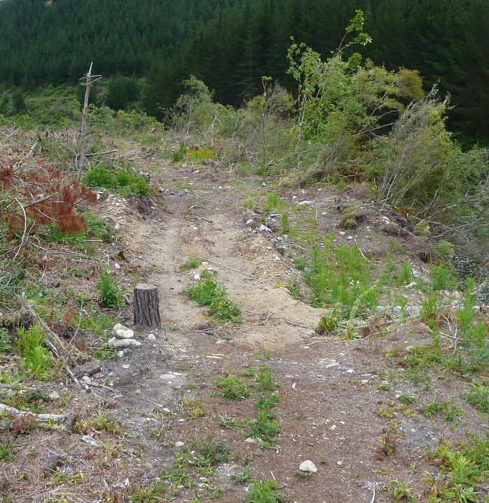
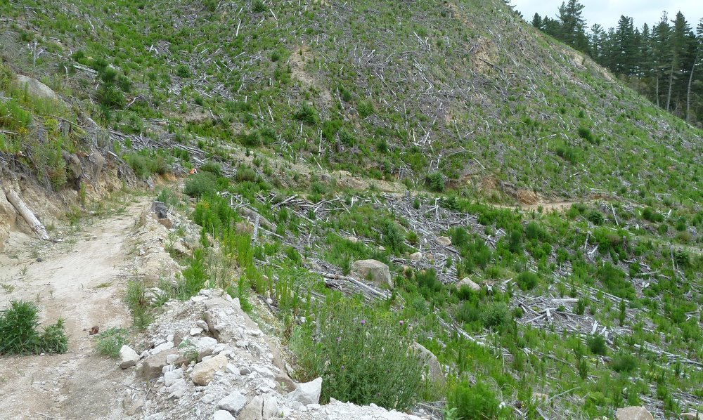
This little slope
(remember that the camera does not show slopes as steep as
they really are) was the most exciting part of the first 5.7km.
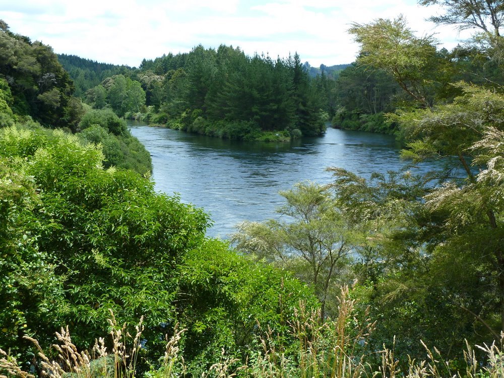
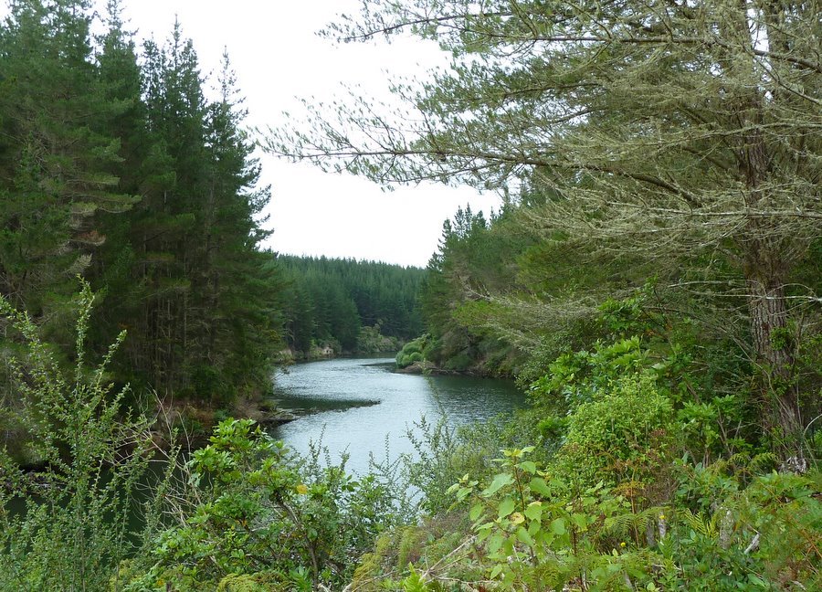
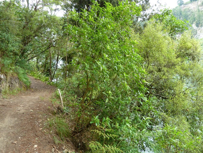
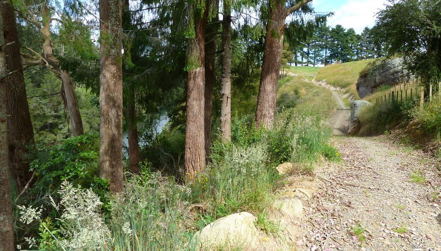
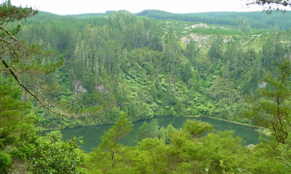
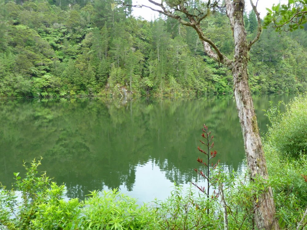
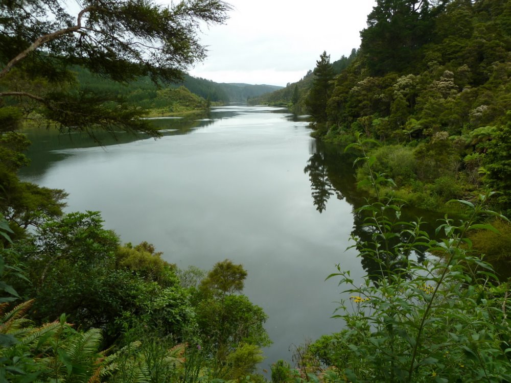
After the Little Waipa Reserve - a better place to start / finish this section - it did become a river trail.
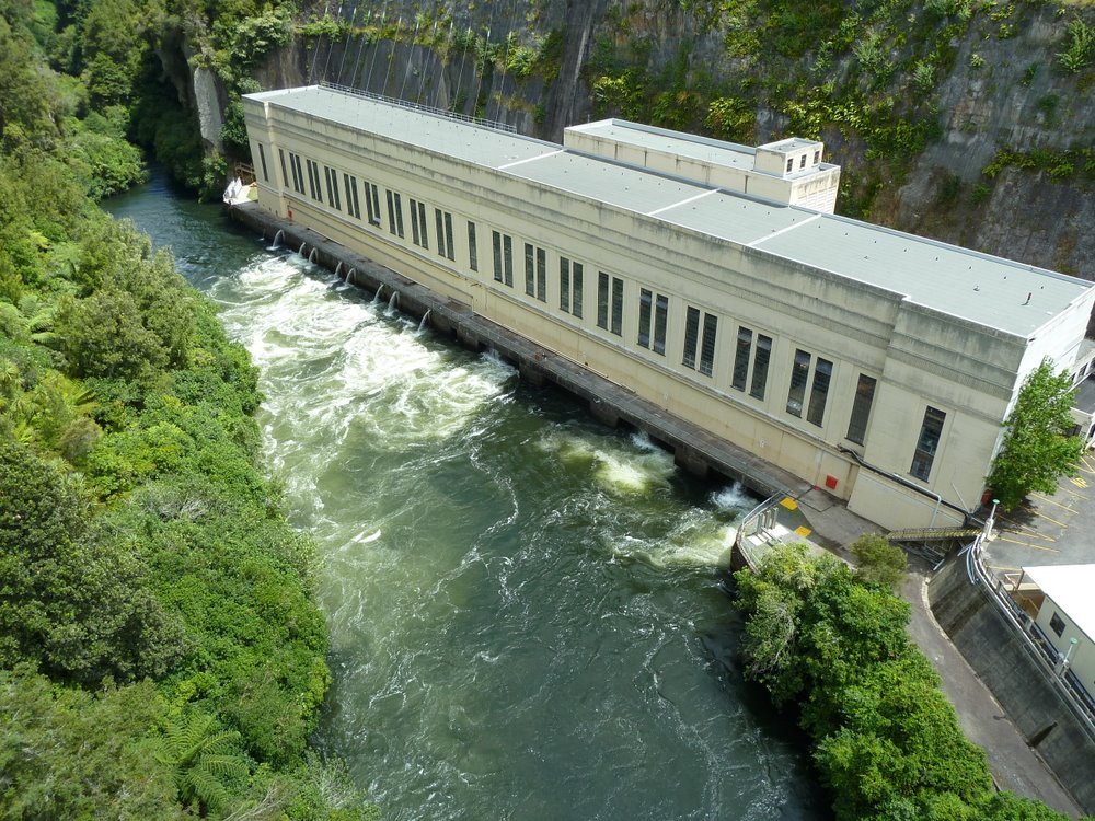
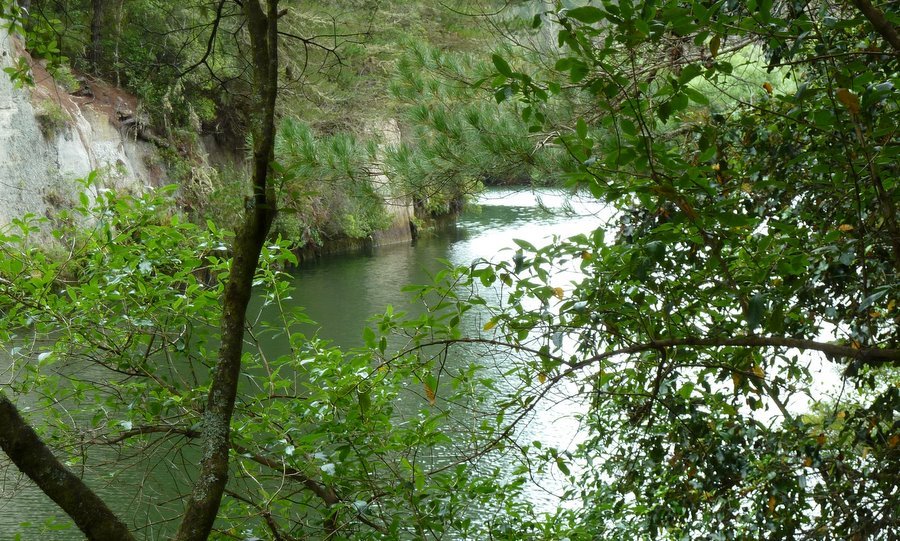
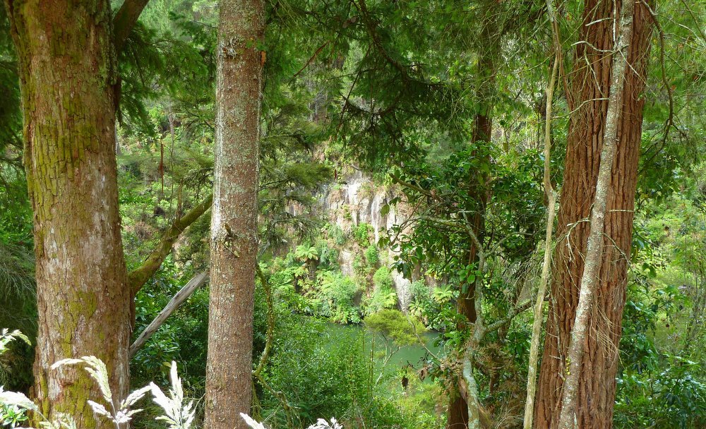
Not far downstream
from the Arapuni Power Station the Waikato, on the left, meets the channel that is part
of Arapuni's overflow system.
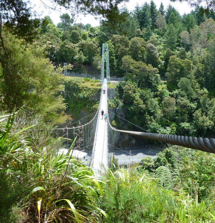
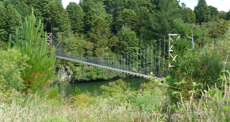
The Arapuni Suspension
Bridge.
It is 152m long, has 54m clearance, and was completed in 1926.
Arapuni Power Station.
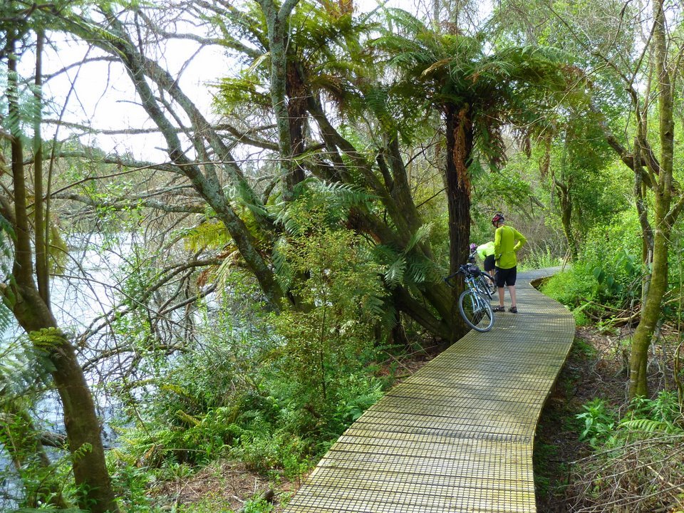
One of the
features of this section is the Huihuitaha Wetlands Boardwalk. It is 500m long.
Do be careful if you meet people coming the other way and have to dismount - watch
where you put your foot.
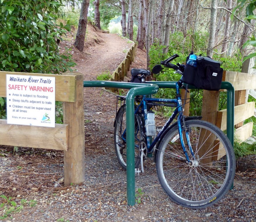
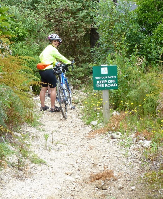
The path has some
of the most ingeniously configured entry barriers.
They are quite effective at stopping anything other than bicycles, but are not
too friendly towards drop handlebars. Which, of course, they are not expecting to
see many.
We came across
several other groups on this section, both cycling and walking, and a few with dogs - even
though the sign bans dogs. There was a sign near Arapuni promising great
coffee at the Rhubarb Caf .
Alas, the owners had not grasped the opportunity offered at this peak time : their sign
said "Closed until 6 January."
After getting an
initial feel for the path with the short, easy, Karapiro Section we decided the best way
to
approach our task was to have a car at each end. While this involved some
considerable back tracking by car
it was better than riding the ensuing sections both ways : once was enough!
Hindsight told us the better way to go would be to have 2 or 3 people per car and have
each group start at
opposite ends of the section and swap car keys when they met.
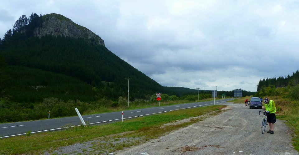
Our day 2 started
at the southernmost end of the Trails, 250m from SH1 at Atiamuri.
This was the Whakamaru Section.
We parked the car and wandered over the road to check the sign.
Unfortunately, it
was not immediately clear that you needed to go left - away from our destination - so we,
and 2
other cyclists, went right.
It soon became
apparent that we were not on the trail and as soon as a forest road opened up, heading
towards the river,
we went down it.
That was not a
good choice, so we went back to the road and backtracked a couple of km to the starting
point,
where the error of our ways was soon obvious.
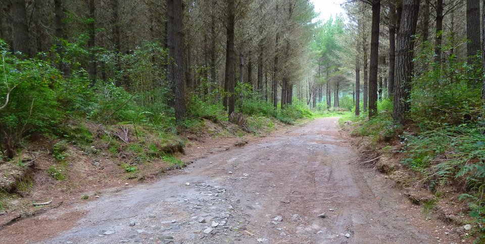
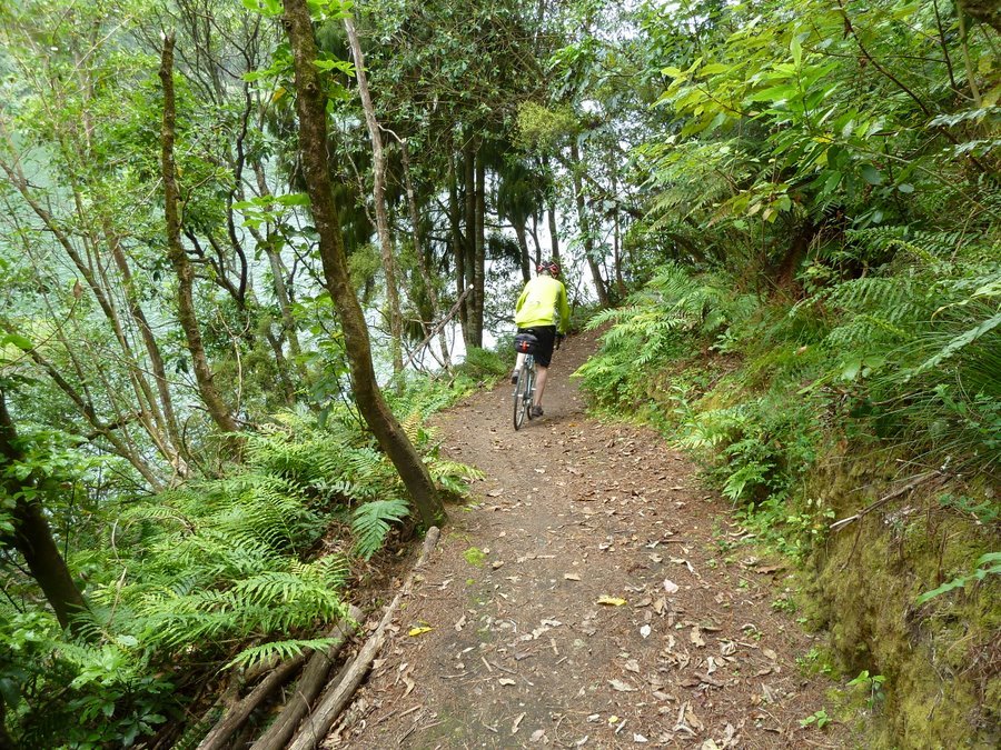
Not far along the track we were greeted with this view.
The track surface here was fairly benign.

But it soon changed. Steep and stony, with pumice sand between the stones.
Sometimes soft patches of pumice sand stopped you without much warning.
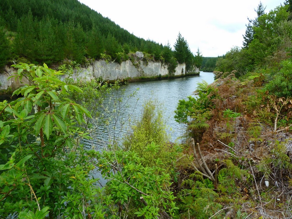
But then you would get another tantalising glimpse of the river.
And another.
And another.
We had seen no
sign that the track had a barrier at this stream.
Walkers would be able - probably - to get across the logs in the stream, but not us.
We backtracked a
few metres and saw a bit of a trail through the long grass.
It lead us to another option to get over the stream.
Sometimes it felt
as though the root judder bars were not going to end.
Many required us to stop and lift the bikes over them.

Another steep little downhill. Miss the bend and you might go swimming.
Looking back to the last bend.
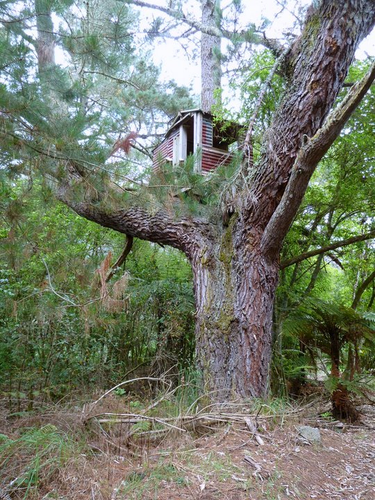
Accommodation if it is taking a little longer than you expected, maybe???.
Reward time.

Looking at the gradient, and the stones, they've got to be kidding.
Another river view.
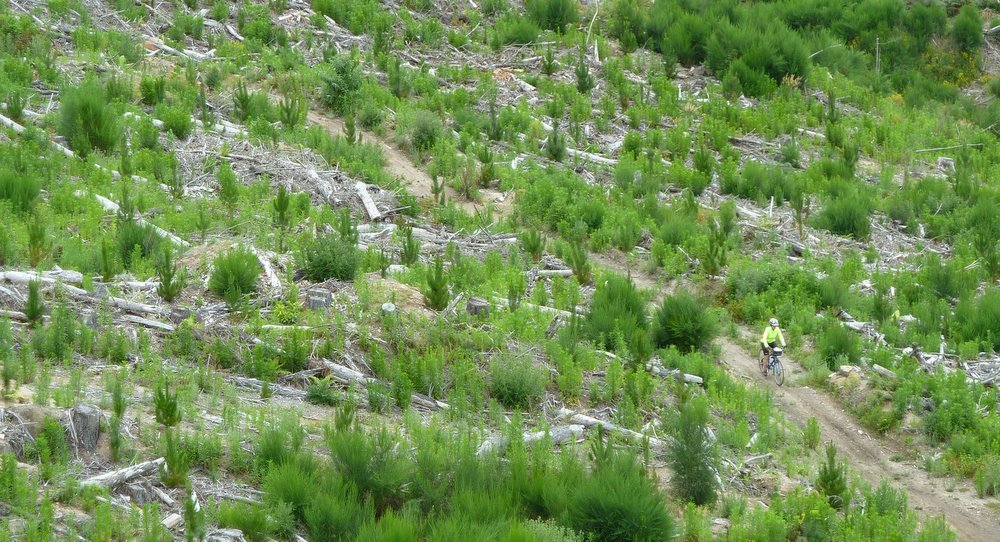
We could see this
guy coming along a section of track alongside the road, and
wondered how he would cope with this steep pinch.
He lost it just after the shutter clicked.
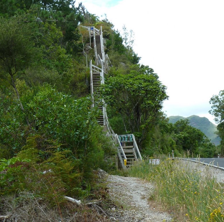
We saw these steps
from a distance and thought, "@@##&%$!**".
But we need not have worried : the white obscured sign tells cyclists to use
the road - carefully - for the next 200 m. We did not venture to the top, but there
was probably a very good view.
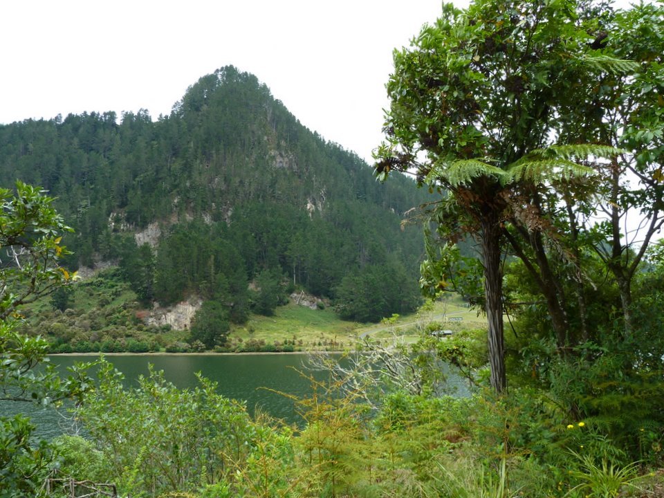
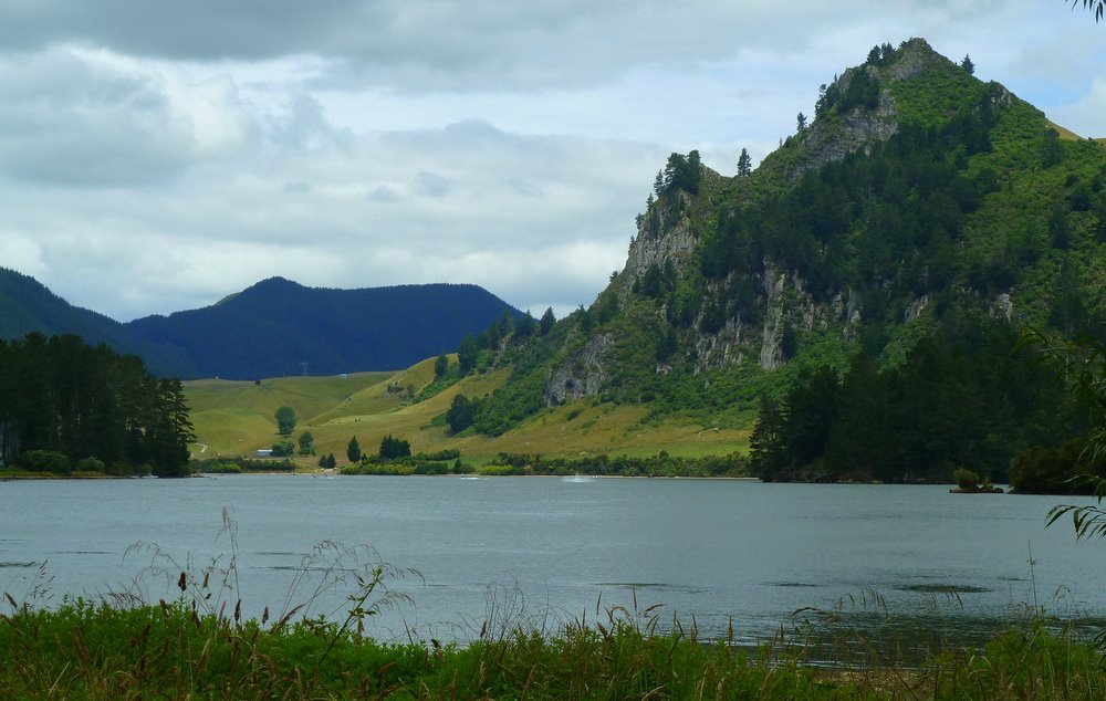
Not far from the
Whakamaru Dam. There's a DoC camp at the point on the left and there were many
fizz boats on the lake.
On this section we
met only 3 other cyclists and 2 walkers until we reached the camp ground above only a
couple of km
before Whakamaru.
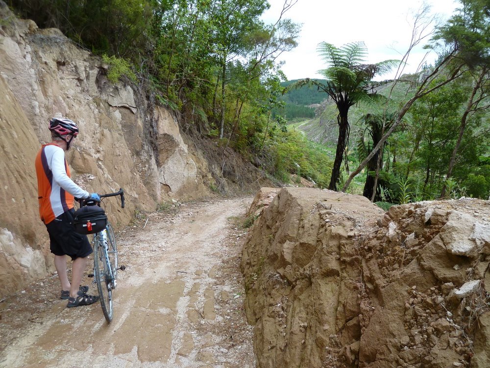
You needed to be ready for steep pinches hidden around bends, often with a loose stony surface.
We had a very
welcome coffee at Whakamaru and then did some car re-postioning so we could do the
Maraetai Section. We continued riding north.
The last 3.5km of
this section is on the road between Mangakino and Maraetai - we decided we
did not need to ride that.
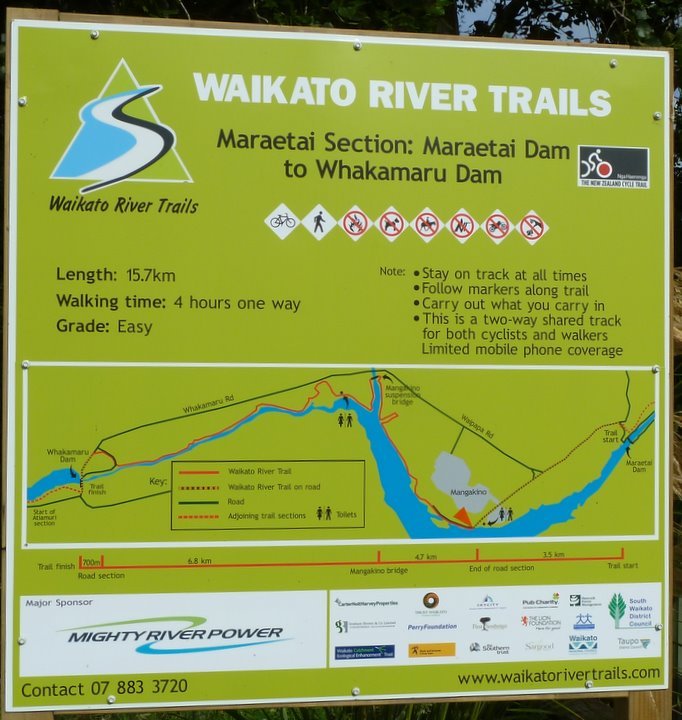
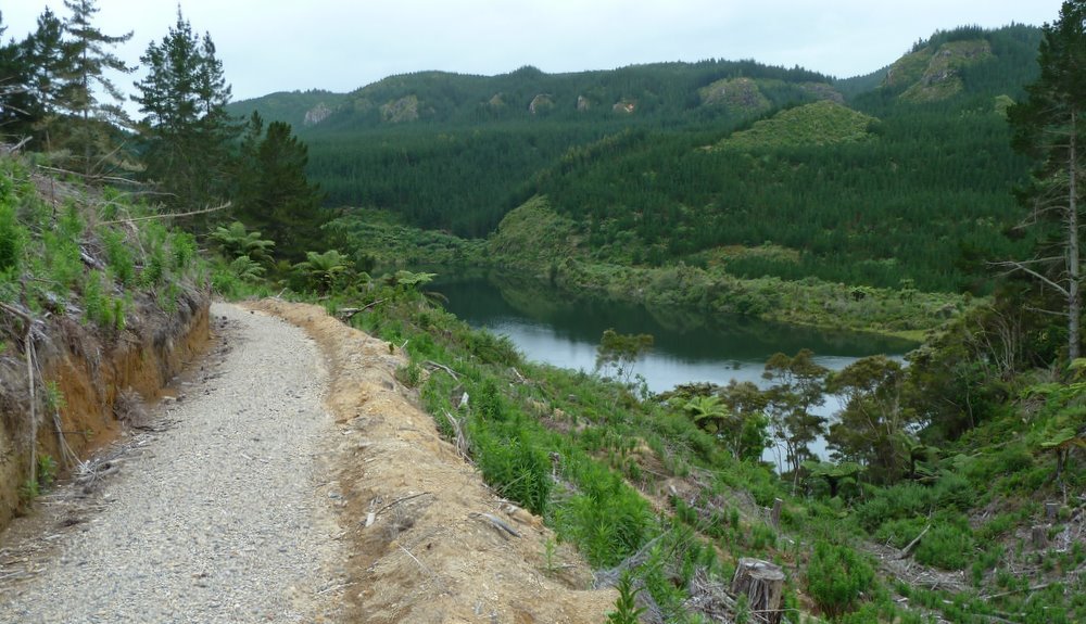
This section has a reasonable surface most of the way.
It starts out high above the river.
And offers tantalising glimpses.
About 7km from Whakamaru you reach the Mangakino Suspension Bridge.
It is followed by
a series of zig-zags. Their major fault was the bends were very sharp and usually
had loose stones making it difficult to cycle round them.
We saw a couple of walkers and a cyclist on this section.
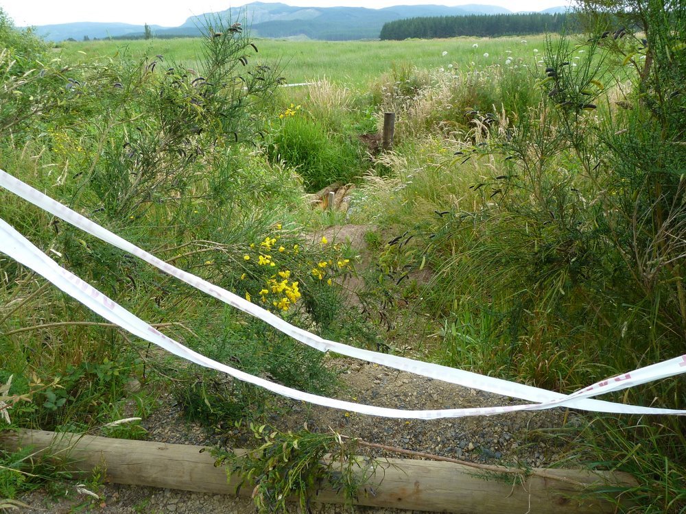
On our last day we
started on the next section - The Waipapa. As you can see from the sign
below the first couple of km were covered in sticking plaster, so we did not get to ride
that bit.
Once again, we rode from south to north.
While relatively short, this was the most challenging section we rode.
Here's challenge #1.
Just look at the size of those thistles!!
Then it started to get interesting.
Look carefully and you will see Ron.
Susan's a bit further down the track.
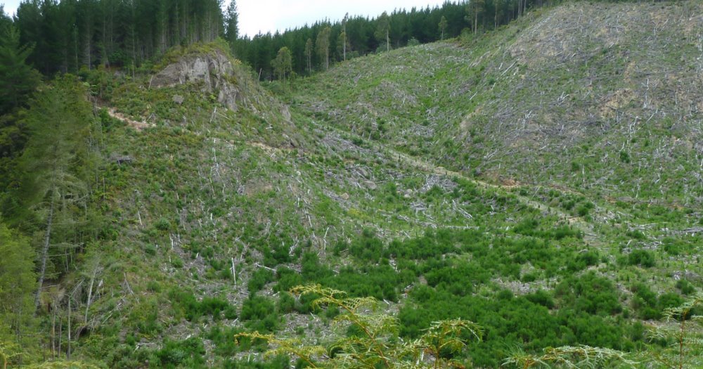
The larger picture.
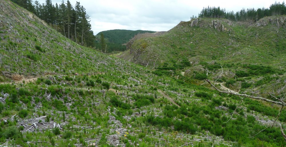
There was a zig-zag up the other side of the valley from where we could see some of what we had just ridden.
At times the path was high above the river.
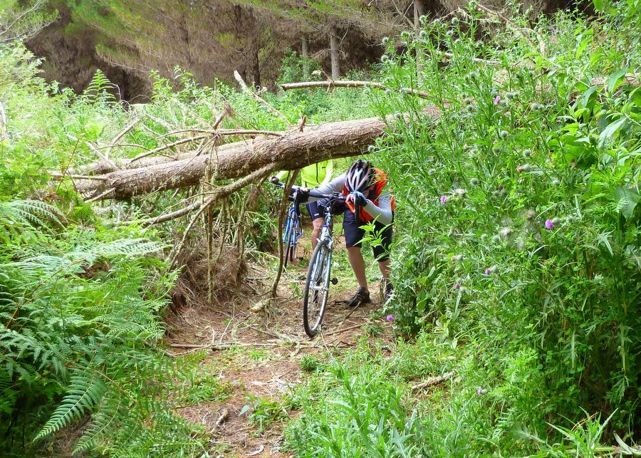
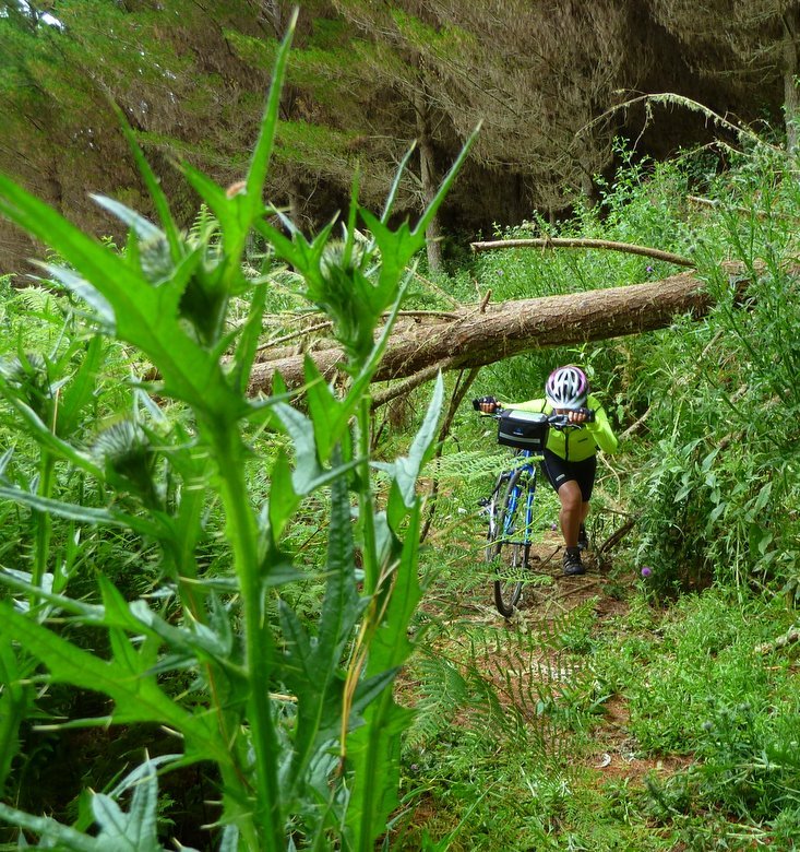
There were more obstacles.
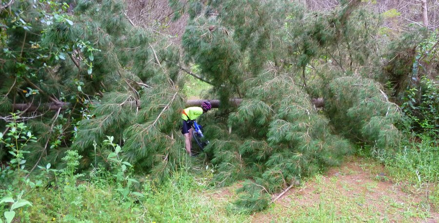
We got down to river level.
Only to climb back up again.
Parts of the path
in this section (and bits of the others) was amply covered in diabolical round stones
which
made riding a little difficult, especially when you lost traction climbing a hill.
Then you dismounted and pushed,
but it was still difficult because the bike would slide away from you and your feet lost
traction.
Back down to river level before the final climb up to the road a couple of km south of
Waipapa.
We saw no one else on this section.
From there we drove back to Mangakino for a coffee and to decide what to do next.
We all agreed that
we had probably had enough - and we did have to drive home this afternoon - but we
did want to look at the Arapuni Section. At least the point where it joined Waotu
South Road.
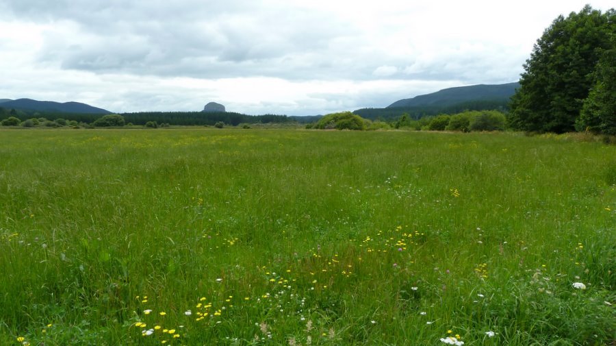
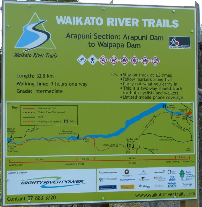
As you can see from the sign there is 15.4 km of this section on the road.
At Waotu South
Road the path goes straight up a hill for 200 metres or so and then gives
stunning views down to the lake and a very large quarry. And the zig-zags start for
the path to get down to river level.
This section has the 47m high Mangarewa Suspension Bridge 5.8km from the road.
We decided it would have to wait for another day.
Photos : John.
The following article appeared in the Herald on 29 December.
The Waikato River Trails section of the New Zealand Bike Trail opens up a beautiful tract of backcountry North Island.
Made up of five trails that follow the Waikato River, it takes in five lakes, four hydro dams, three swing bridges (two built for the trail, one towering 45m above a gorge stream) and lengthy sections of wetlands boardwalk.
Two of the five trails in the 100km route make for easy riding while the middle and most remote section (north and south of Waipapa Dam on the Arapuni and Waipapa trails) is demanding mountainbiking terrain.
In this part is a stretch of 26 hairpin bends as the track drops quickly from a plateau of farmland to the river's edge.
Opened in November, this is the second section of Nga Haerenga - The New Zealand Cycle Trail - to be fully opened.
A bike trail running the length of the country was the big idea of a Government-led jobs summit in 2009 and enthused Prime Minister John Key.
Most of the Waikato trail is not ideal for touring bikes, and New Zealand still needs a mapped and signposted network on quiet roads to steer riders away from busy highways.
Development of the Waikato River Trails began in 2003 as a walking route and was adapted to cater for cyclists after the bike trail idea gained traction. Its origin can be seen in the middle, with a short series of stairs, and on many tight bends where the camber slopes the wrong way for cyclists.
But these minor quibbles are more than made up for by the spectacular views and mostly excellent trails.
The NZbyBike website rates the Waikato River Trails as one of the most demanding of the planned great rides, while the official NZ bike trail website describes it as "advanced".
Taken as a whole, I'd agree, but the easiest sections are not much more demanding than the Otago Rail Trail, require no more than moderate bike-fitness and would suit families. But it has a few sharp little climbs.
These easy trails - the 15km Maraetai section from Mangakino Lake Front Reserve to Whakamaru Dam, and the Karapiro leg to Arapuni - are in the southern and northern parts of the route.
The Karapiro leg starts at Pokaiwhenua Bridge, 5km along Horahora Rd off the main highway. Be watchful, the sign is easy to miss.
From here it's 14km to the cute hydro town of Arapuni.
My riding mate, Jackson Foster, and I were initially bemused as the first 5km of the trail is beside the road (because of land firmness issues, we were told). But from Little Waipa Domain, the route follows the river through lush bush on a well-made trail right into Arapuni.
Highlights include 500m of boardwalk through the Huihuitaha wetland, and the Arapuni swing bridge and power station.
The only other person we saw on the section was a fly-fisherman on a promontory, engrossed in a languid dance with an unseen trout.
The bike trail may be just the tonic to breathe new life into these forgotten gems set in stunning landscapes, just as the Otago Rail Trail has done for the gold towns of the Maniototo.
Arapuni is already awakening.
Bryan and Louise Samuel have established the excellent Rhubarb Cafe in the village, while several doors away Steve and Lorraine Gaunt are converting two sleepouts into Arapuni Backpackers. Just 10km down the road is Lance and Mary Hodgson's sumptuous Out In The Styx guesthouse.
IF YOU GO
The trails: Are 100km and follow the river from Lake Karapiro to Atiamuri, taking in five lakes, four hydro dams and three swing bridges in stunning, sometimes remote, territory. Two-four days are recommended to complete all five sections. A third is easy riding, a third moderate, a third adventurous. The trail managers will help plan drop-offs, pick-ups and accommodation. Phone: (07) 883-3720, or check out waikatorivertrails.com.
Want to tell the Webmaster something?
