![]()
Elevations
South Island Tour 2011
Christchurch to Springfield.
Rangiora to Springfield.
(Following the devastating earthquake in Christchurch on 22 February many riders will be starting their tour at Rangiora.)
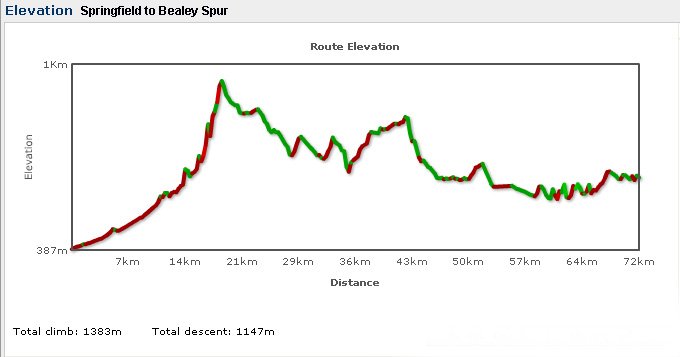
Springfield to Bealey Spur.
Bealey Spur to Moana.
Map
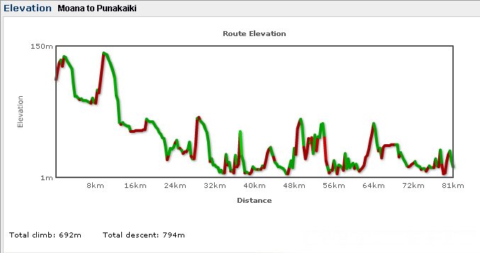
Moana to Punakaiki.
Map
Punakaiki to Westport.
Map
Westport to Denniston and back.
Map
Westport to Murchison.
Map
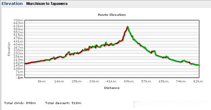
Murchison to Tapawera.
Map
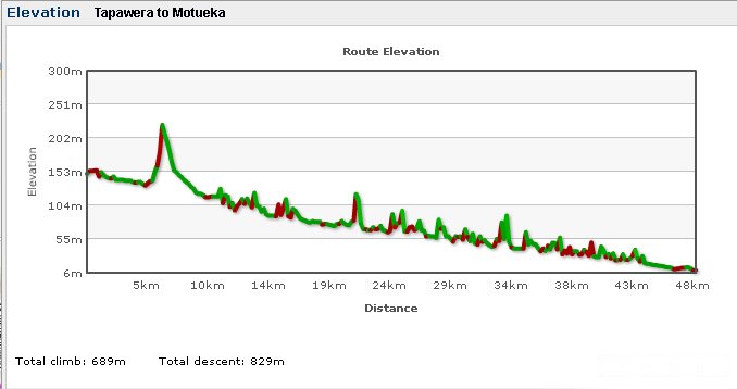
Tapawera to Motueka.
Map
Motueka to Pohara.
Map
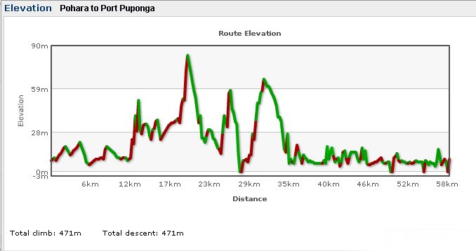
Pohara to Port Puponga.
Map
Port Puponga to Motueka.
Read the above two charts backwards.
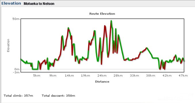
Motueka to Nelson.
Map
The Tour ends at Nelson, but some riders will probably cycle back to Picton, so....
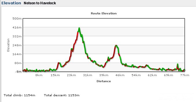
Nelson to Havelock.
Map
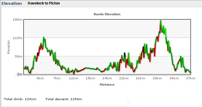
Havelock to Picton.
Map
Want to tell the Webmaster something?